
Anjana River and urban settlements of Krishnanagar, Dogachi, Dharmadaha, Patuli, Badkulla, Chandandaha and Vyaspur (West Bengal, India)
This pilot project builds on research conducted for a M.Sc. thesis (2021) on the applicability of Elinor Ostrom’s effective governance framework in the case of a small river in the Ganga-Brahmaputra-Meghna Delta.
Between 16th to 17th century, the Anjana, a small distributary river located near Kolkata, India, was an important inland trading route in the lower delta of the Ganga-Brahmaputra-Meghna Delta. The beauty of the river was immortalised by poets since medieval times (Figure 1). The river was used as a waterway to carry indigo, rice, and fabric from the hinterlands of Nadia towards Calcutta port (Figure 2, above).
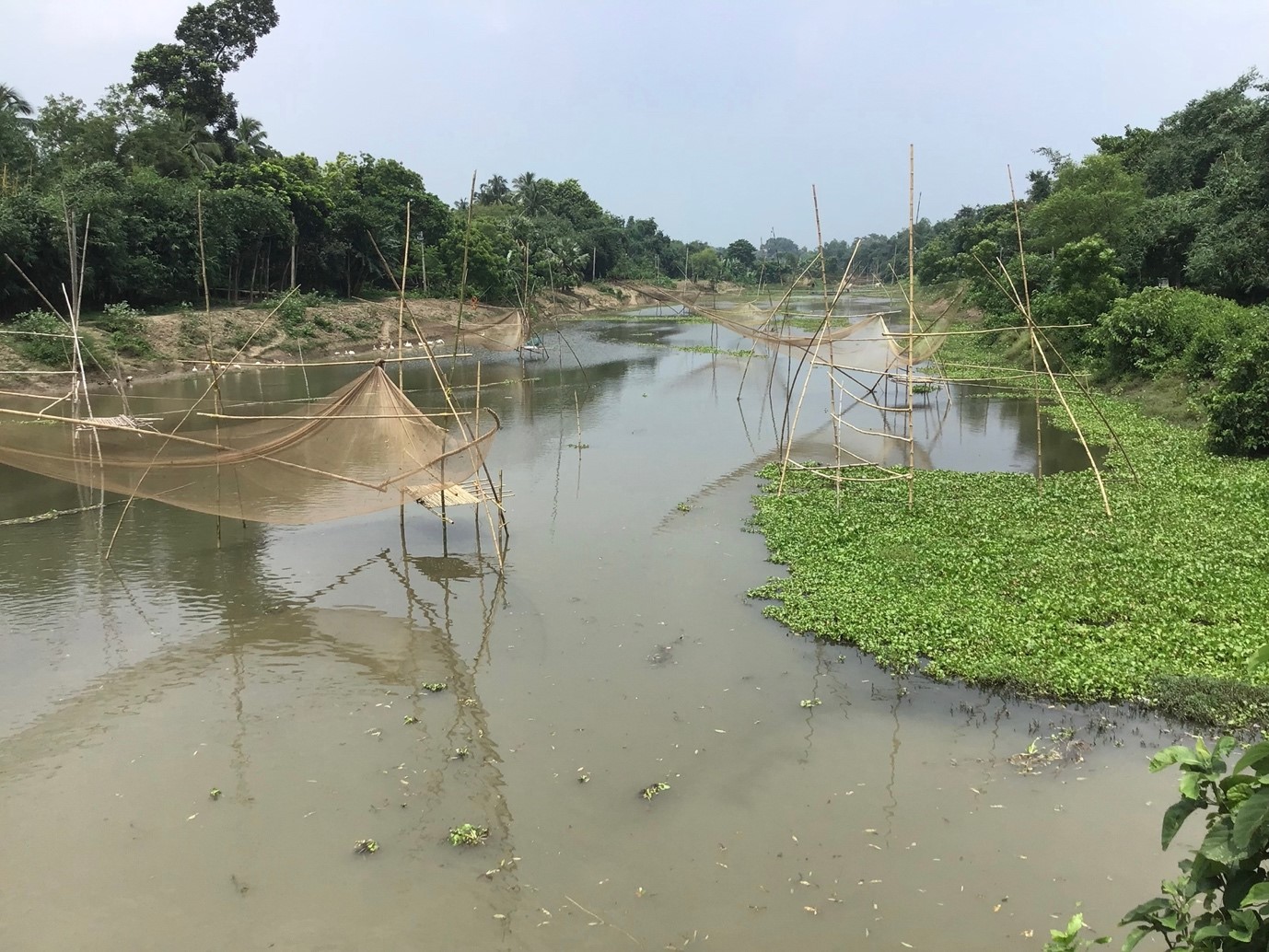
Figure 1: Fishing nets on Anjana River, Vyaspur. Source: Nath, S.S (2021)
After the indigo revolt of the 1860s, the river functioned only as minor waterway. The quality of the water and the beauty of the river made king Krishna Chandra build his capital beside the river (Image 3).
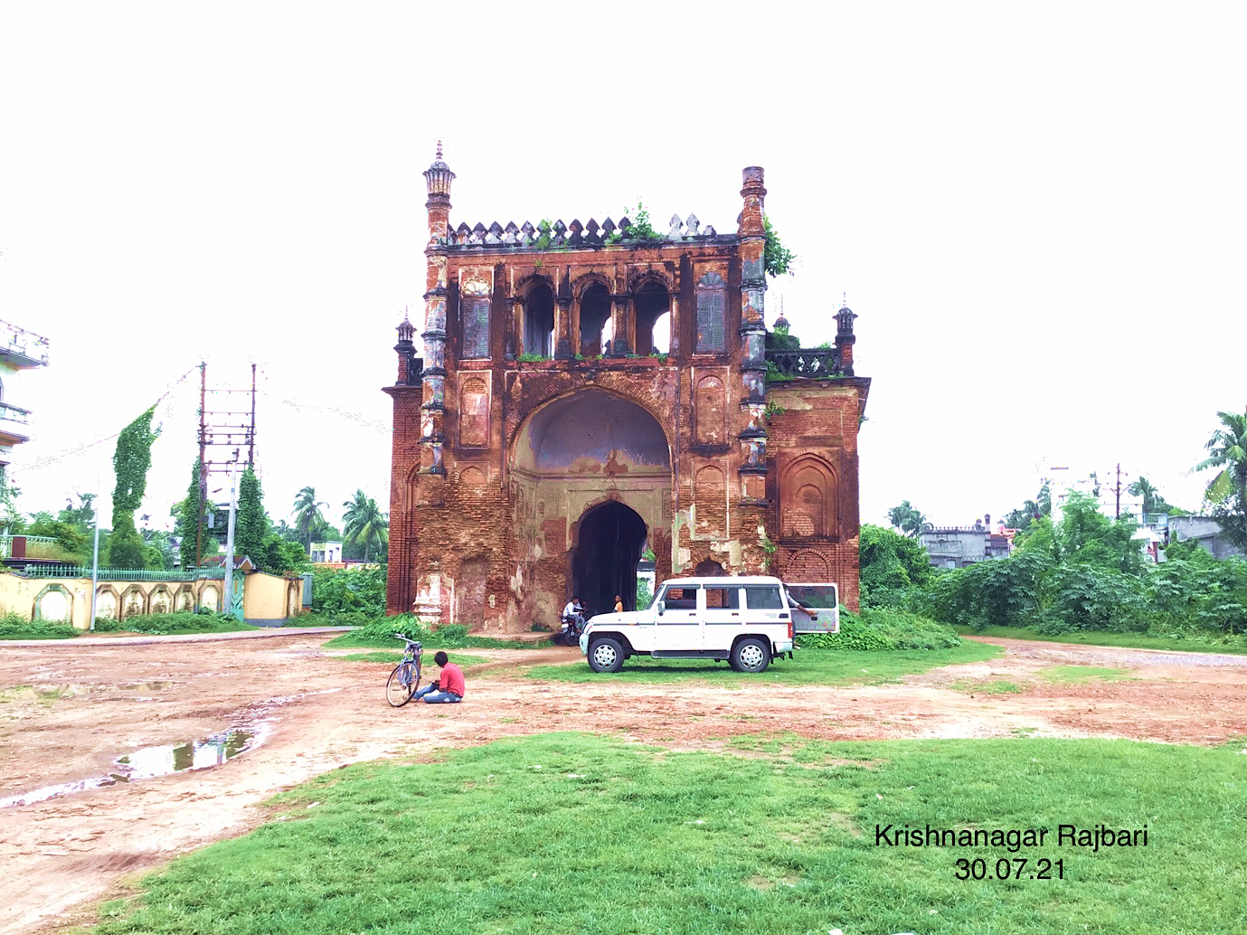
Figure 3: Entrance to Krishnanagar Palace, Krishnanagar, Nadia. Source: Nath, S.S (2021)
The river, like many other water commons in India, was governed and managed by local communities depending on the river. Over time the condition of the river has degraded due to various anthropogenic activities. Since 1948, parts of the river are encroached heavily to meet ever-increasing demands of land for urbanisation. In other areas, the river is blocked along its width for fish farming (Figure 4).
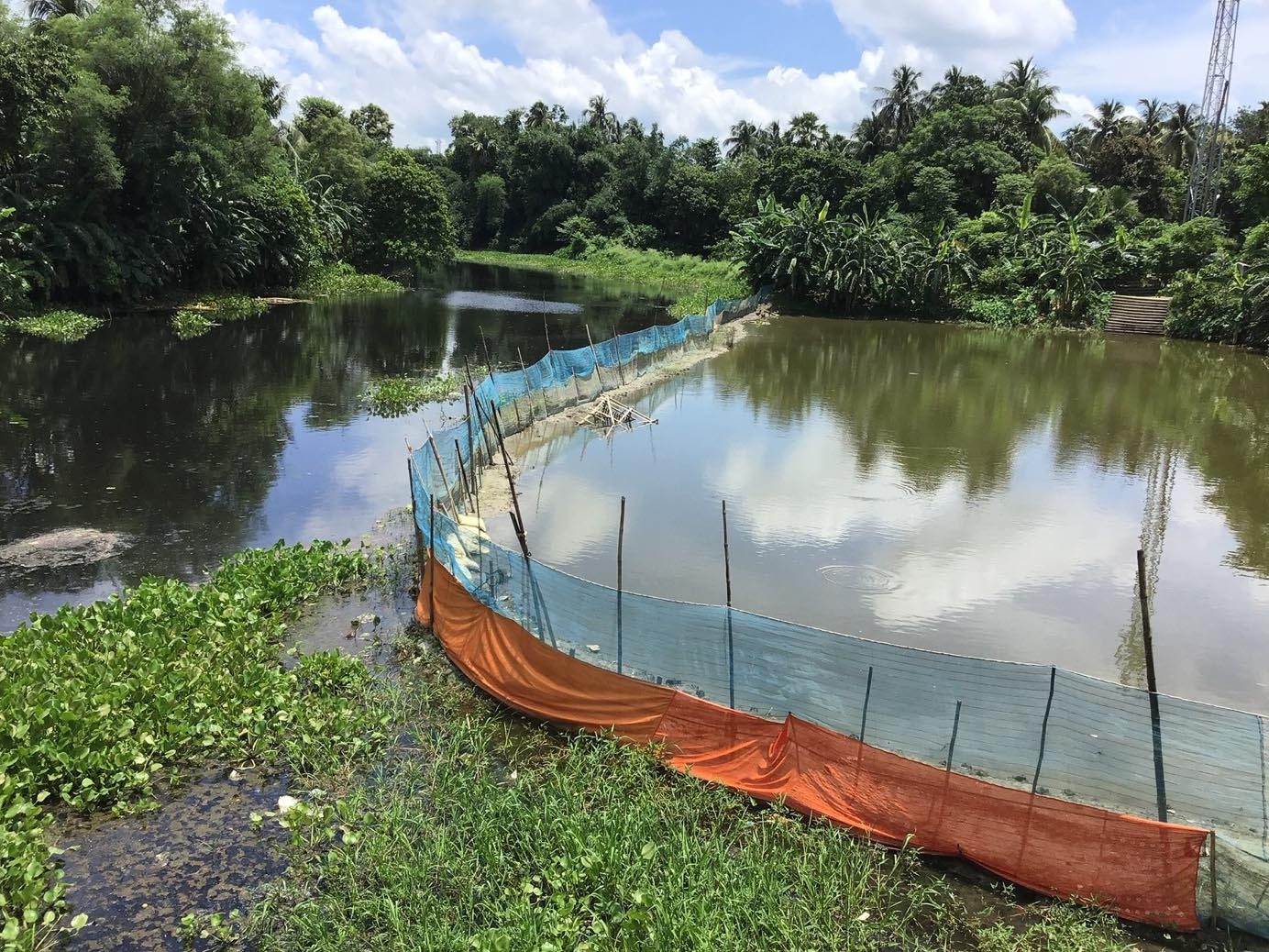
Figure 4: Enclosures across the river made for fish farming, Dogachi. Source: Nath, S.S (2021)
The mouth of the river is completely blocked today. The river is used primarily for disposal of garbage, which has disrupted the river as well as communities dependent on it. The depth of the river has diminished heavily, and the water has become putrid (Figure 5). Aquatic flora and fauna have ceased to exist in the river. Additionally, the actor-institution nexus and overpoliticization have aggravated the situation.
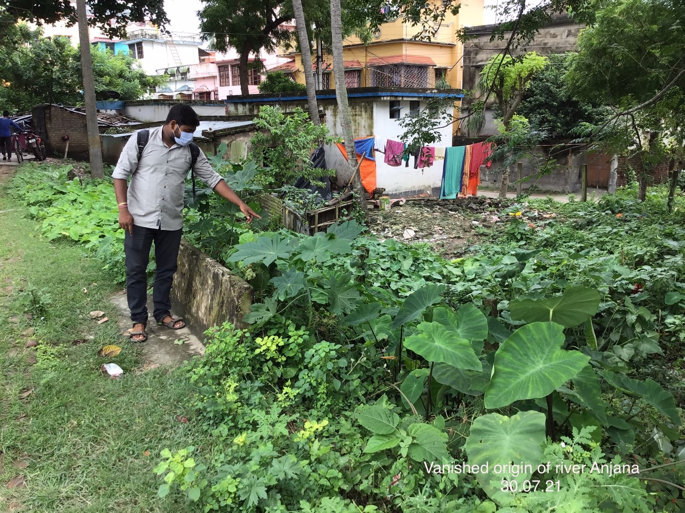
Figure 5: Local resident pointing towards the blocked origin of Anjana River from Jalangi river. Source: Nath, S.S (2021)
As a result, the communities dependent on the Anjana River for their livelihood are forced to abandon their trades or they have to migrate (Figure 6). As the number of people depending on the river has diminished, the informal governance of the river has also become non-existent. This has created a vicious cycle, which has also altered the relationship between humans and the river, which still forms the backbone of the lives of many thousands of households living in the delta (Figure 7).
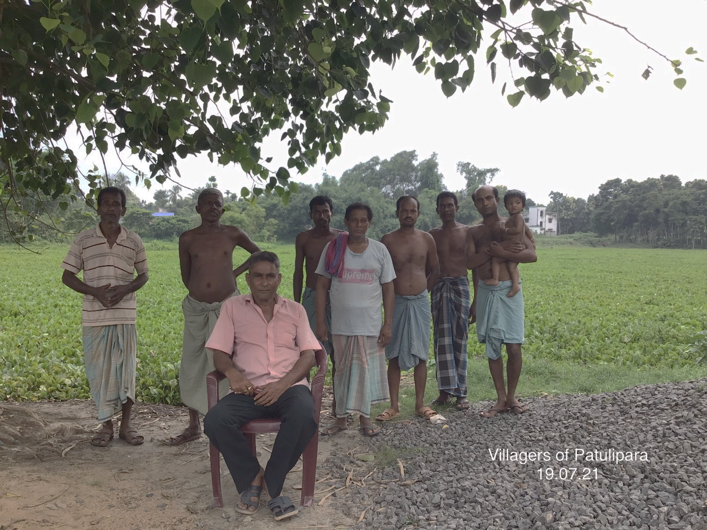
Figure 6: Fishing community living beside Anjana River, Patulipara. Source: Nath, S.S (2021).
In the “River Cities as Method” river bios component, the project team tries to understand the history of the Anjana River, the history of the adjacent urban and rural areas, and the history of its people. It also tries to understand the human-land-water interaction through analyses of medieval texts, literature, historical records, and tacit knowledge.
In the mapping component, the project team tries to map the old course of the river and the chronological changes to it. It also tries to trace the 16th century settlement patterns. In addition, it tries to map the water quality, environmental conditions, socio-economic conditions. The team will also conduct a perceptions mapping of governance. These mappings will help to understand the chorological changes, identify and measure disruptions, and prepare for the necessary transformative actions.
In the revitalization component, the pilot project aims to achieve transformative resilience by means of an action plan to improve the quality of water, aesthetics, and flora and fauna of the Anjana River. It also aims to revitalise the livelihoods of the people dependent on the river. At the same time, it intends to improve the socio-cultural relationship between the river and its people. Finally, it tries to create a long-term sustainable pathway for the river and the surrounding areas.
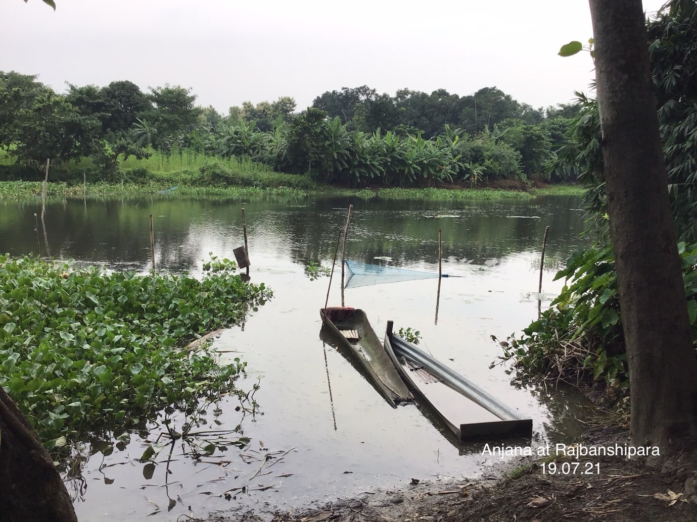
Figure 7: Decaying state of Anjana River, Rajbanshipara. Source: Nath, S.S (2021)

